Heightmap to STL Converter
Drop a greyscale heightmap and get a watertight 3D printable solid with a base, sized in millimetres. Free, in your browser, nothing uploaded.
In short: To convert a heightmap to STL, drop the greyscale PNG or JPG into the MeshShift relief tool. Each pixel's brightness becomes height: white is the highest point and black the lowest, or the reverse with Invert. Set the width in millimetres, the base thickness and the maximum height, add smoothing if the image is noisy, and check the 3D preview with its real size.
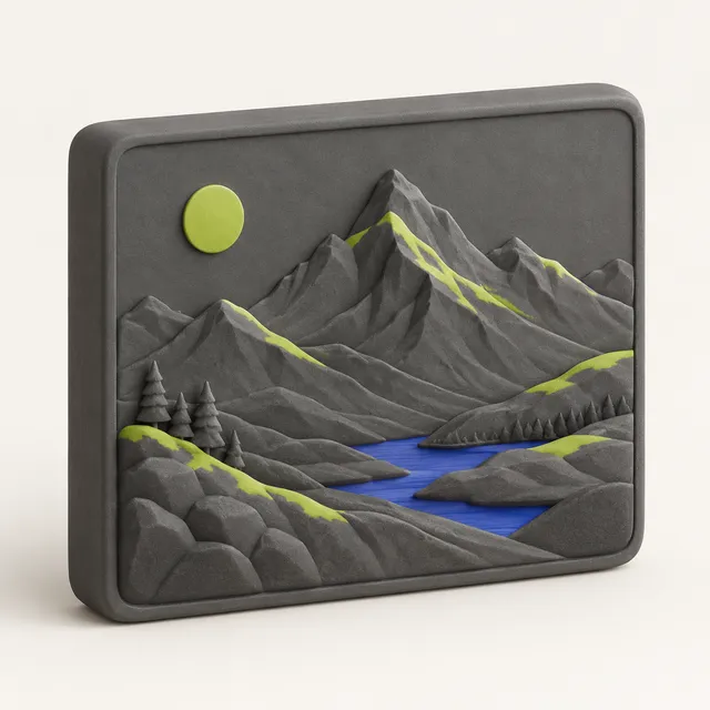
The download is a closed, watertight STL with flat sides and a solid base, so it slices without repair, unlike converters that output an open surface. It works for terrain from DEM or Terrain.party exports, Blender or game-engine heightmaps, displacement textures and depth maps. Everything runs in your browser, so large heightmaps are never uploaded and there is no account, watermark or file limit. You can also download a 3MF with mm units, free, so the model opens at the size you set in Bambu Studio, OrcaSlicer or PrusaSlicer instead of being scaled by a slicer guessing inches. The 3MF is the same closed solid as the STL, with no account, watermark or file limit.
How to use the Heightmap to STL Converter
- Drop the heightmap image (PNG, JPG, WebP, HEIC or BMP).
- Keep Relief mode; turn on Invert if dark should be high.
- Set the width in mm, base thickness and maximum height.
- Add smoothing for noisy or 8-bit maps and check the preview.
- Download the watertight STL.
How the height scale works
The tool maps the darkest pixel to the base top and the brightest to the base plus the maximum height you set. For real terrain, choose the vertical scale on purpose:
- A 100 mm wide print of a 10 km area is at 1:100,000. True-scale mountains of 1 km would be only 10 mm tall and look flat.
- Most terrain prints use 2 to 4 times vertical exaggeration so ridges and valleys read clearly.
- For city or coastal areas with little relief, push it further, 5 to 10 times.
Write the exaggeration on the base or the back so people know the hills are steeper than life.
Getting a good heightmap
- **Terrain:** export a DEM from USGS EarthExplorer, OpenTopography or Tangram Heightmapper, or use a Terrain.party style PNG. Crop to the area you want before converting.
- **Blender and games:** bake a height or displacement map, or export the terrain heightmap from Unity, Unreal or World Machine.
- **Depth maps:** AI depth estimators produce greyscale depth images that also work, giving a relief of a photo with real depth instead of brightness.
8-bit images have 256 height levels, which shows as small terraces on tall prints. Smoothing hides most of it; for steep terrain a 16-bit PNG converted to 8-bit with dithering also helps.
Why a closed solid matters
Many heightmap converters output only the top surface, an open sheet with no sides or bottom. Slicers either refuse it or guess and produce gaps. MeshShift builds the walls and a flat bottom and joins them to the surface, so the result is one watertight shell. You can also see the print time and size before downloading, and the same tool makes lithophanes and stamps if you change the mode.
Print settings for terrain and textures
Print flat on the bed. Use 0.08 to 0.12 mm layers for fine relief; the layer height limits how many height steps show. Variable layer height in PrusaSlicer or Bambu Studio keeps flat areas fast and slopes smooth. Two walls and 10 to 15 % infill are enough. A 150 mm terrain tile at 0.12 mm takes roughly 3 to 6 hours. For colour-banded maps on a multi-material printer, split the model by height in the slicer and assign a filament to each band.
Frequently asked questions
Is white high or low in the heightmap?
White is high by default, the convention in most terrain and game tools. Turn on Invert for depth maps where dark is near, so the nearest areas are tallest.
Is there a size limit?
No upload limit, because the image never leaves your browser. Very large maps are resampled to keep the mesh printable, and the preview shows the final triangle count.
Can I make a terrain map STL for free?
Yes. The STL download is free with no account or watermark. 3MF export is free too.
Why does my print show steps?
An 8-bit heightmap has only 256 levels, and your layer height adds its own steps. Raise smoothing, use a smaller layer height, or print with variable layer height.
Can I use a heightmap for a lithophane?
Yes. Switch the mode to lithophane: the image becomes a thin panel whose thickness follows the brightness, which shows the picture when lit from behind.